25 new cities accredited for exceptional efforts to safeguard urban wetlands

Urbanization is one of the key defining mega-trends of our time. Four billion people, about half of the world’s population, currently live in urban areas. This number is expected to dramatically increase with the predicted rise in urbanization rates. According to The Nature in the Urban Century report, authored by The Nature Conservancy, Future Earth and The Stockholm Resilience Centre, by 2050, there will be 2.4 billion more people in cities, a rate of urban growth that is equivalent to building a city the population of London every seven weeks. Humanity will urbanize an additional area of 1.2 million km2, larger than the country of Colombia.

The report also found that if current trends continue over the next two decades, urban growth will threaten more than 290,000 km2 of habitat — an area larger than New Zealand. Protected lands are increasingly in close proximity to cities, with 40% of strictly protected areas anticipated to be within 50 km of a city by 2030.

The urbanization trend poses a major threat to several critical ecosystems, including wetlands. Wetlands can play a crucial role in urban biodiversity, and in maintaining ecosystems and the well-being of urban communities. When preserved and sustainably used, urban wetlands can provide cities with multiple economic, social and cultural benefits. During storms, urban wetlands absorb excess rainfall, which reduces flooding in cities and prevents disasters and their subsequent costs. The abundant vegetation found in urban wetlands acts as a filter for domestic and industrial waste and contribute to improving water quality.

As cities grow and the demand for land use increases, the tendency is for development to encroach on wetlands, because they are often perceived as wastelands that can be used as dumping grounds or converted for other land uses.

Urban wetlands are prized assets, not wasteland, and therefore should be proactively conserved and integrated into the development and management plans of cities. The Convention on Wetlands (also known as the Ramsar Convention) is promoting cities that take exceptional steps to protect their wetlands and benefits to people, by giving credit to cities that prioritize their urban wetlands through an accreditation scheme.

The 172 Contracting Parties to the Convention on Wetlands have agreed to the conservation and wise use of wetlands in their territories. Recognizing the importance of cities and urban wetlands, the Convention introduced a Wetland City accreditation scheme in 2015 (Resolution XII.10). This voluntary scheme provides an opportunity for cities that value their natural and/or human-made wetlands to gain international recognition and positive publicity for their efforts. Cities must apply to be accredited and they have to show that they comply with a number of criteria, including exceptional protection, care and wise use of their wetlands through a range of mechanisms such as urban planning and education.

2018

During the first cycle of the City Accreditation Scheme, the 18 cities that qualified for accreditation were announced at the Convention of Wetlands COP13 in 2018. These 18 cities were:

  • China: Changde, Changshu, Dongying, Haerbin, Haikou, Yinchuan
  • France: Amiens, Courteranges, Pont Audemer, Saint Omer
  • Hungary: Lakes by Tata
  • Republic of Korea: Changnyeong, Inje, Jeju, Suncheon
  • Madagascar: Mitsinjo
  • Sri Lanka: Colombo
  • Tunisia: Ghar el Melh

The intention is that The Wetland City Accreditation scheme will encourage cities in close proximity to and dependent on wetlands, especially Wetlands of International Importance, to highlight and strengthen a positive relationship with these valuable ecosystems, for example through increased public awareness of wetlands and participation in municipal planning and decision-making. The Accreditation scheme should further promote the conservation and wise use of urban and peri-urban wetlands, as well as sustainable socio-economic benefits for local people.

During the 59th meeting of the Convention on Wetlands Standing Committee on 26 May 2022, the Co-Chairs of the Convention on Wetlands Independent Advisory Committee on Wetland City Accreditation announced that 25 applicant cities had been accepted in recognition of their exceptional efforts to safeguard urban wetlands for people and nature.

Congratulations to the cities that have been accredited! One of the cities, Cape Town, is one of the pioneer CitiesWithNature – a global partnership initiative that recognizes and enhances the value of nature in and around cities across the world. The 2022 accredited cities are:

2022

During the second cycle of the City Accreditation Scheme, 25 cities qualified for accreditation and were announced during the Convention on Wetlands Standing Committee of May 2022. These newly accredited cities will be formally recognized during the COP14 of the Convention on Wetlands, to be held in November 2022.

These 25 cities are:

  • Canada: Sackville
  • China: Hefei; Jining; Liangping; Nanchang; Panjin; Wuhan; and Yangcheng
  • France: Belval-en-Argonne and Seltz
  • Indonesia: Surabaya and Tanjung Jabung Timur
  • Islamic Republic of Iran: Bandar Khamir and Varzaneh
  • Iraq: Al Chibayish
  • Japan: Izumi and Niigata
  • Morocco: Ifrane
  • Republic of Korea: Gochang; Seocheon; and Seogwipo
  • Rwanda: Kigali
  • South Africa: Cape Town
  • Spain: Valencia
  • Thailand: Sri Songkhram District

With the release of the Intergovernmental Science-Policy Platform on Biodiversity and Ecosystem Services (IPBES) global assessment, it is increasingly clear that biodiversity and natural ecosystems play a crucial role in maintaining the health of the planet, particularly in the face of climate change.

The natural environment provides many valuable and free services that contribute directly to human well-being and livelihoods. In a rapidly urbanizing world, cities and their surrounding areas will play a key role in leading action to protect the natural ecosystems that support to human life and vibrant economies.

Recent history has seen the large-scale replacement of natural ecosystems with built up areas, putting cities and their surroundings under increased pressure in terms of resource scarcity, degraded air and water quality, and reduced green space. But this does not have to be the case – local and regional governments are already working to mainstream biodiversity planning into local policies and ensure that the natural ecosystems that support human life are protected.

Natural asset mapping is a first step towards raising awareness of the critical role that nature and natural ecosystems play in supporting healthy and balanced urban life. It is also a key step for local governments to take in order to integrate ecosystem management into urban planning.

How natural asset mapping works

Dar es Salaam in Tanzania is one of nine cities that has worked with ICLEI to map its natural assets through the INTERACT-Bio project. This project supports expanding urban communities in the Global South to improve the utilization and management of nature while providing them with nature-based solutions and associated long-term benefits.

These cities used a two-step methodology for the mapping process. First, high-resolution remotely sensed spatial data was acquired from the European Space Agency’s Sentinel 2 mission and the project team worked closely with GeoTerraImage to develop land cover classes that highlight areas which provide ecosystem services, such as wetlands, mangroves, grasslands and woody vegetation. This analysis resulted in a detailed baseline spatial dataset that defines 12 different classes of landcover and can be used to generate a variety of mapping outputs and analytics.

The second step combines the data and information generated from the remote natural asset mapping process with local spatial information about urban nature features and the state that they are in, scientific studies and a deliberately participatory and iterative process to gather input from local experts and city officials.

Through natural asset mapping that combines customized earth observation data and information with input from local experts and stakeholders, local governments can make informed decisions about managing and investing in green space and green and blue infrastructure that enhances resilience and nature-based development.


The value of nature in Dar es Salaam

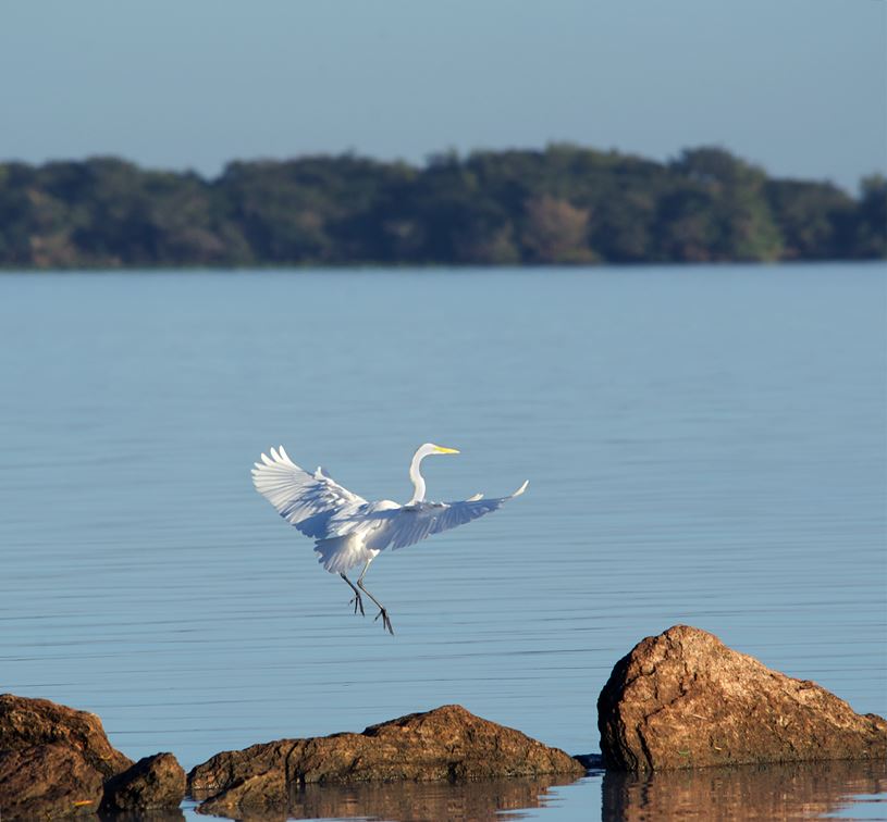
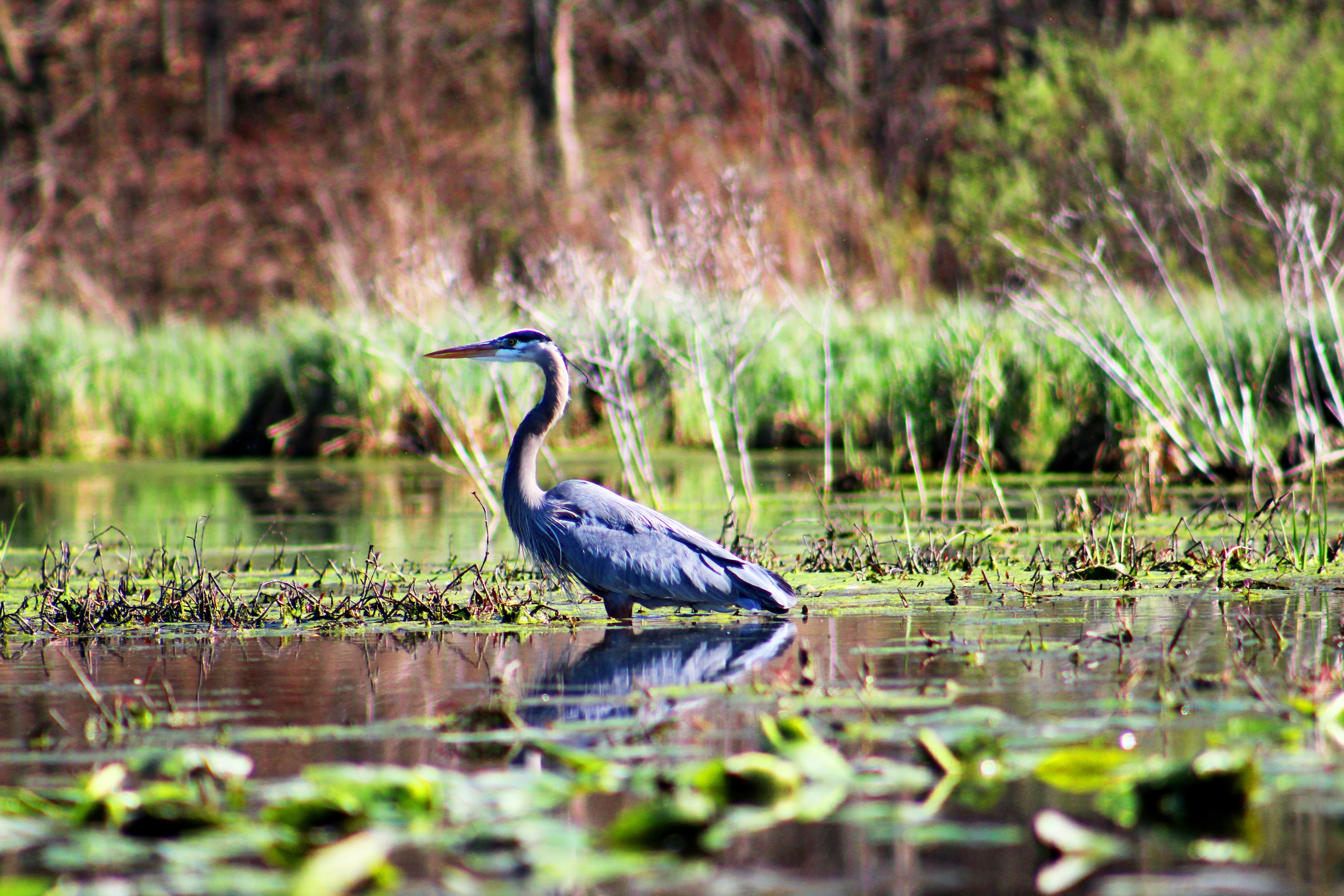
Dar es Salaam has many important natural areas that support the city and its people. Its natural assets range from beaches, rivers, mangroves, coastal and Afromontane forests to wildlife such as birds, bats, monkeys, rich marine life, and coastal plants and animals.

With careful planning, these natural resources can be protected, enhanced and even expanded to sustainably provide many benefits. These include enhanced fresh water provision, food, timber, jobs, cooling of the city, reduced air pollution, protection against natural disasters, opportunities for tourism, recreation and relaxation, and a sense of place.

During the mapping process in Dar es Salaam, city representatives and local experts identified challenges such as dwindling green open spaces, over exploitation of natural resources like indigenous trees and urban heat island effect as key priorities for the city to address.

The natural asset mapping pulled on local knowledge and research and yielded a collection of thematic and explanatory maps that make the case for the importance of green open space in the city and establishing a record which the city can work from to develop policy and practice.

The strength of this approach is that the maps can be overlaid to expose areas where investment in greening can deliver and optimize desired benefits, such as cooling and air pollution reduction.

This approach also highlights potential partnerships. For example, the transport sector implements greening as well as the City Council. The maps identifies areas where these sectors can collaborate and co-invest their greening budgets to optimize urban ecosystem benefits.

A summary document with key maps and information, with policy and action recommendations was developed as a tool that will support they city in making strong arguments for investing in urban nature and nature-based solutions.

The thematic mapping also formed the basis for the development of an illustrated poster of Dar es Salaam that show the natural assets in the city in an attractive and accessible format. The purpose is to create awareness of the presence and value of nature in cities and to inspire officials and the public to protect and benefit from urban nature.

This article originally appeared on CityTalk, a blog by ICLEI.