London becomes first National Park City

Today, 22nd July 2019, marks the occasion where London launched the National Park City Charter.

Yesterday, in London, the National park City Universal Charter was also launched to spread this incredible initiative to other cities. As a growing network of cities, researchers, practitioners, individuals, communities, and partners dedicated to urban nature, CitiesWithNature endorses this momentous occasion and stands ready to support the vision and National Park City team. Show your support today! Anyone, anywhere can be a part of this amazing initiative to transform our cities into CitiesWithNature.

“As London prepares to commit to becoming the first National Park City, we hope to see many cities follow suit through the launch of the Universal National Park City Charter on 22 July. A momentous step forward in building and growing CitiesWithNature. Congratulations to London!”
– Kobie Brand, Global Director: Biodiversity, ICLEI

As cities continue to grow and the natural environment continues to diminish at alarming rates, the time is now, like never before, to unite under a common vision to transform our cities into healthier, greener, fairer, and more harmonious places to live. As we rapidly approach the year 2020, arguably the most critical moment in the history of our planet where the “New Deal for Nature” will be negotiated, cities are at the forefront of the global collective action that will see better connections between people and nature forged in the post 2020 era. We hope to see many other cities embarking on the journey to become CitiesWithNature, and we are thrilled to endorse the National Park City Universal Charter as one of the tools that has the potential to see this global vision realised.

The universal charter, which we encourage all individuals and cities to sign, can be found here.

By signing this document you will be showing your support for the vision of National Park Cities and will be pledging to help make them a success.

“As cities continue to grow and the natural environment continues to diminish at alarming rates, the time is now, like never before, to unite under a common vision to transform our cities into healthier, greener, fairer, and more harmonious places to live. As we rapidly approach the year 2020, arguably the most critical moment in the history of our planet where the “New Deal for Nature” will be negotiated, cities are at the forefront of the global collective action that will see better connections between people and nature forged in the post 2020 era. We hope to see many other cities embarking on the journey to become CitiesWithNature, and we are thrilled to endorse the National Park City Universal Charter as one of the tools that has the potential to see this global vision realised.”
– Timothy Blatch, CitiesWithNature Program Coordinator

In Portland, Oregon, annual rainfall exceeds a staggering 37 inches (the US average is about 32). When it rains, excess storm water collects dirt, soil, and other pollutants and then drains into the main water system. In 2017 it was estimated that Portland has spent a cumulative $370 million on infrastructure, such as pipes and sewer separations, to tackle the problem.

Then in 2007, the government launched the Green Streets project. The city planted beds of shrubs and trees on sidewalks, absorbing the runoff and limiting the flow of water to the drainage system. It marked a new, mixed approach to tackling their problems with excess rainfall; employing the power of nature itself alongside traditional, “grey” infrastructure.

Green Streets is an example of a “Nature-based Solution” — a policy that preserves, rehabilitates, protects and sustainably manages natural habitats, species, and ecosystems that have been damaged by human activity for environmental and societal benefits.

Read the original article on Apolitic’s website here.


Last week at the Manchester Festival of Nature celebration event at Heaton Park, Manchester became the first UK City to sign up to the International CitiesWithNature portal, a Global network aimed at sharing best practice approaches around Nature conservation.

CitiesWithNature is a partnership between ICLEI- Local Governments for Sustainability, IUCN (International Union for the Conservation of Nature) and The Nature Conservancy. These international organisations have access to a wealth of expertise from city administrations and subject specialists worldwide.

This is also an exciting opportunity to promote the good work already happening in Manchester to a fast-growing international audience.  One such example of this work is in West Gorton, where Manchester’s participation in the European-funded ‘Grow Green’ project will deliver a new community park with innovative water-retention features.

“Manchester takes it commitments to nature conservation seriously, and we want to shape our city accordingly with the best advice possible; CitiesWithNature will support us on our journey in making Manchester an even more nature-friendly city. It’s very appropriate that we make this statement after a month-long wildlife focussed campaign engaging with thousands of people through the City’s first Festival of Nature”.

– Cllr Angeliki Stogia


Spending at least 120 minutes a week in natural environments is associated with good health and wellbeing, according to a study published in Scientific Reports.


Mathew White and colleagues surveyed 19,806 adults in England on how much time they had spent over the past week in natural environments, such as fields and woodlands (but not including their own garden), and their self-reported health and wellbeing. They show that people who reported spending 120 minutes or more in nature were more likely to report good health or high levels of wellbeing.

The authors found this association was independent of the size of the available green space in their local neighbourhood. The relationship was also seen in participants of all ages, including those with long-term health issues, which may suggest that the findings were not simply due to healthier people visiting nature more often. It did not matter if the 120 minutes were spent in nature on one occasion or several shorter visits throughout the week, the authors report. Spending under 120 minutes a week in nature was not associated with improved wellbeing, while spending between 200–300 minutes in natural environments showed no additional benefit.

The authors conclude that, although preliminary, the findings represent an important starting point for discussions around providing simple, evidence-based recommendations about the amount of time spent in natural settings that could result in meaningful promotion of health and wellbeing.

Original post here.

In celebration of International Day for Biological Diversity, CitiesWithNature – a global knowledge sharing platform launched by ICLEI, IUCN and The Nature Conservancy – has a new tool to help integrate nature into cities. The Nature Pathway on CitiesWithNature is a collection of guidance, tools and inspirational examples that help local and regional governments to share their work on nature and learn about best practices and tools.

The Nature Pathway guides cities on a journey of exploration and inspiration, where they can share with and learn from other cities. Along this journey, cities can show their commitments and ambitions towards incorporating nature’s benefits and nature-based solutions into city policy, planning and decision-making processes and implementation.

The CitiesWithNature online platform has been endorsed by the Secretariat of the Convention on Biological Diversity (SCBD) as the official mechanism to coordinate local and subnational ambitions and commitments towards global efforts in halting biodiversity loss and protecting our natural world.

Local leaders are already stepping up. Ashok Sridharan, Mayor of Bonn, Germany, and President of ICLEI is encouraging local leaders to join the movement: “The scientific evidence on the biodiversity crisis is alarming  and taking action is an imperative. Local and regional governments understand best how biodiversity in our cities protects lives and livelihoods. They can and should play a major role in protecting and restoring our natural world. The CitiesWithNature platform provides the strongest way forward for cities to change our current trajectory, and that‘s why I’m asking my fellow city leaders to join the city of Bonn in becoming a part of CitiesWithNature.”

The Nature Pathway is based on an ICLEI methodology with three main phases: Analyze, Act and Accelerate. Each of these phases is divided into steps and each step is accompanied by a rich collection of information including guidance, tools, ideas and examples.

Cities can learn from the successes of peers and share their own work on nature through the platform, adding to a growing body of examples, tools and data on how cities are incorporating nature into their urban landscapes, plans and policies.

For example, step one asks cities to commit to and mobilize towards becoming a city with nature and offers resources on how to develop a strategy and action plan for nature in your city. The City of Melbourne has shared its ‘Nature in the City Strategy’ as an example of making a commitment to nature.

Every city has different challenges and priorities, and the diversity of the Nature Pathway can help all cities take the next step. Each city can meet its specific nature-based needs, but can also contribute to a global movement of by sharing experiences and tools that assist other cities in achieving their goals.

City residents can keep up with what their city is doing and sharing by viewing their city’s profile on CitiesWithNature, which is a summary of a city’s commitment and work in this area, and a celebration of their natural assets.”

Through this journey, cities can contribute to global goals such as the objectives of the Convention on Biological Diversity’s Strategic Plan for Biodiversity (2011-2020), the Aichi Biodiversity Targets and the Sustainable Development Goals.

The CitiesWithNature Registry and Nature Pathway have been produced as part of the INTERACT-Bio project. This project is supported by the German Federal Ministry for the Environment, Nature Conservation and Nuclear Safety (BMU) through the International Climate Initiative (IKI).

Original article here: https://iclei.org/en/media/new-free-tool-helps-cities-mainstream-nature-into-urban-planning

With the release of the Intergovernmental Science-Policy Platform on Biodiversity and Ecosystem Services (IPBES) global assessment, it is increasingly clear that biodiversity and natural ecosystems play a crucial role in maintaining the health of the planet, particularly in the face of climate change.

The natural environment provides many valuable and free services that contribute directly to human well-being and livelihoods. In a rapidly urbanizing world, cities and their surrounding areas will play a key role in leading action to protect the natural ecosystems that support to human life and vibrant economies.

Recent history has seen the large-scale replacement of natural ecosystems with built up areas, putting cities and their surroundings under increased pressure in terms of resource scarcity, degraded air and water quality, and reduced green space. But this does not have to be the case – local and regional governments are already working to mainstream biodiversity planning into local policies and ensure that the natural ecosystems that support human life are protected.

Natural asset mapping is a first step towards raising awareness of the critical role that nature and natural ecosystems play in supporting healthy and balanced urban life. It is also a key step for local governments to take in order to integrate ecosystem management into urban planning.

How natural asset mapping works

Dar es Salaam in Tanzania is one of nine cities that has worked with ICLEI to map its natural assets through the INTERACT-Bio project. This project supports expanding urban communities in the Global South to improve the utilization and management of nature while providing them with nature-based solutions and associated long-term benefits.

These cities used a two-step methodology for the mapping process. First, high-resolution remotely sensed spatial data was acquired from the European Space Agency’s Sentinel 2 mission and the project team worked closely with GeoTerraImage to develop land cover classes that highlight areas which provide ecosystem services, such as wetlands, mangroves, grasslands and woody vegetation. This analysis resulted in a detailed baseline spatial dataset that defines 12 different classes of landcover and can be used to generate a variety of mapping outputs and analytics.

The second step combines the data and information generated from the remote natural asset mapping process with local spatial information about urban nature features and the state that they are in, scientific studies and a deliberately participatory and iterative process to gather input from local experts and city officials.

Through natural asset mapping that combines customized earth observation data and information with input from local experts and stakeholders, local governments can make informed decisions about managing and investing in green space and green and blue infrastructure that enhances resilience and nature-based development.


The value of nature in Dar es Salaam

Dar es Salaam has many important natural areas that support the city and its people. Its natural assets range from beaches, rivers, mangroves, coastal and Afromontane forests to wildlife such as birds, bats, monkeys, rich marine life, and coastal plants and animals.

With careful planning, these natural resources can be protected, enhanced and even expanded to sustainably provide many benefits. These include enhanced fresh water provision, food, timber, jobs, cooling of the city, reduced air pollution, protection against natural disasters, opportunities for tourism, recreation and relaxation, and a sense of place.

During the mapping process in Dar es Salaam, city representatives and local experts identified challenges such as dwindling green open spaces, over exploitation of natural resources like indigenous trees and urban heat island effect as key priorities for the city to address.

The natural asset mapping pulled on local knowledge and research and yielded a collection of thematic and explanatory maps that make the case for the importance of green open space in the city and establishing a record which the city can work from to develop policy and practice.

The strength of this approach is that the maps can be overlaid to expose areas where investment in greening can deliver and optimize desired benefits, such as cooling and air pollution reduction.

This approach also highlights potential partnerships. For example, the transport sector implements greening as well as the City Council. The maps identifies areas where these sectors can collaborate and co-invest their greening budgets to optimize urban ecosystem benefits.

A summary document with key maps and information, with policy and action recommendations was developed as a tool that will support they city in making strong arguments for investing in urban nature and nature-based solutions.

The thematic mapping also formed the basis for the development of an illustrated poster of Dar es Salaam that show the natural assets in the city in an attractive and accessible format. The purpose is to create awareness of the presence and value of nature in cities and to inspire officials and the public to protect and benefit from urban nature.

This article originally appeared on CityTalk, a blog by ICLEI.

A new international scientific report warns of grave impacts to come as nature declines at an unprecedented rate. The report from the Intergovernmental Science-Policy Platform on Biodiversity and Ecosystem Services (IPBES) estimated that one million species are threatened with extinction today and that extinction rates are accelerating.

It is the first global assessment on the state of biodiversity since 2005. Called “the Global Assessment Report on Biodiversity and Ecosystem Services,” it finds that the current global response is insufficient and transformative change is needed.

The global assessment is “the most important report the world needs to take note of. We want to thank and salute the scientific community from around the world who worked for so many long hours, weeks, months and indeed years to bring us the report, with its very clear wake-up call,” said Kobie Brand, Global Director, ICLEI Cities Biodiversity Center.

The report was authored by 145 experts – with contributions from 300 more – from 50 countries and took three years to create. It is based on the systematic review of about 15,000 scientific and government sources, as well as indigenous and local knowledge and charts the changes seen in biodiversity from the last fifty years, showing the relationship between economic development and impacts on nature.

Sunandan Tiwari, Director Global Implementation at ICLEI World Secretariat, represented the organization at the stakeholder day prior to the 7th session of the IPBES Plenary, at which members adopted the report. ICLEI’s message was “as urbanization is one of the key threats to biodiversity, we encourage IPBES members to engage local and regional governments in the second work programme.” The second work programme is the next phase of activities to be carried out by IPBES.

The report also presents a collection of potential actions in urban areas to protect biodiversity. These include implementation of nature-based solutions, increasing access to urban services and a healthy urban environment for low-income communities, improving access to green spaces, and sustainable production and consumption and ecological connectivity within urban spaces, particularly with native species, as strategies for change.

The release was accompanied by strong messages on the importance of nature through the METZ Biodiversity charter adopted by the G7 Environment Ministers which specifically calls for the engagement of local and other subnational governments and the OECD report on the economic value of nature which makes the business case for action on biodiversity.

The original article appeared on ICLEI‘s website.


By Rob McDonald, Lead Scientist for Global Cities, The Nature Conservancy

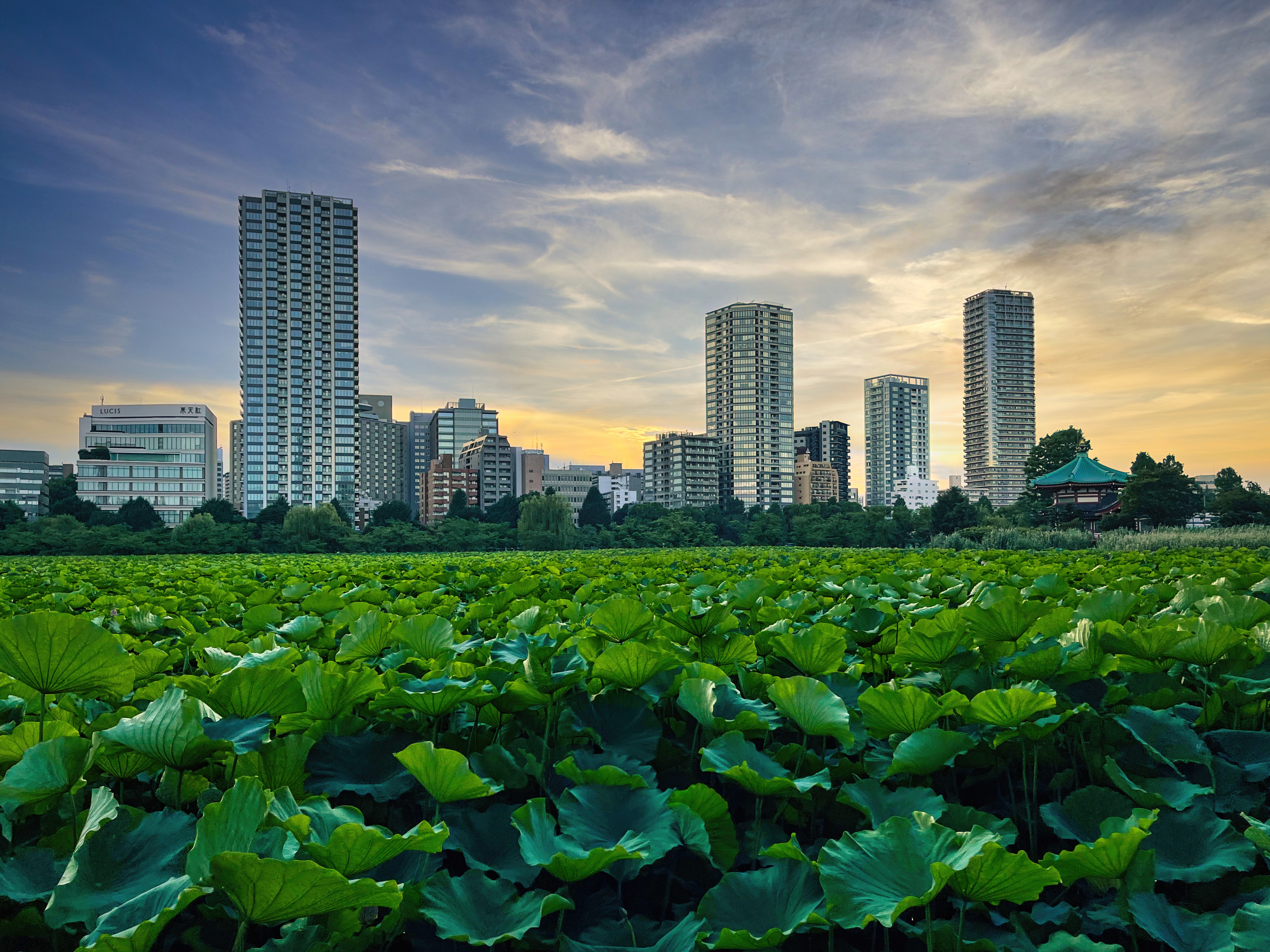
This century will be remembered as the urban century. Our generation will witness the most significant urban growth in human history. By 2050, there will be 2.4 billion more people in cities, a rate of urban growth that is the equivalent of building a city the population of New York City every six weeks. Humanity will have urbanized an area of 1.2 million km2, larger than the nation of Colombia.

Cities have been called humanity’s greatest invention, a way of living that can bring many benefits. Relative to more rural areas, cities have increased economic productivity and innovation, greater opportunities for education and individual enhancement, and more efficient use of resources. But the rapid growth of cities presents a challenge to the global environment, both directly through the expansion of their footprint and indirectly through urban energy and resource use. How can there be space for the natural world in an urban world?

Dozens of the world’s scientists have united to answer these questions, in a new effort we call the Nature in the Urban Century Assessment, which finds that urbanization trends could result in significant biodiversity loss, if global leaders do not take timely action to invest in more sustainable cities.

The goal of the Nature in the Urban Century Assessment is to describe globally where and how to conserve nature in the face of urban growth, for the benefit of both biodiversity and human well-being. Our report projects that urban growth could threaten 290,000 km2 of natural habitat between 2000 and 2030. Habitat loss will be most extensive in temperate and tropical forests, including key areas for global biodiversity conservation. Targeted action in these places facing outsized impact—which include parts of the United States, Brazil, Nigeria and China—could make a real difference in preventing biodiversity loss.

A large proportion of some other biomes, including Mediterranean-type habitat and mangroves, will also be affected. We show that biodiversity loss will be spatially concentrated, with urban growth in a few specific places having an outsized impact on biodiversity globally. For instance, conservation action on just 49,000 km2 could help protect Key Biodiversity Areas (KBAs) at risk from urban growth.

Urban growth could also affect parks and other protected natural areas. By 2030, we project that 40 percent of strictly protected areas (where resource harvesting is forbidden) and one in two loosely protected areas will be within 50 km of an urban area. This increased proximity will raise the likelihood of negative impacts on these urban-adjacent protected areas, as well as increase management costs.

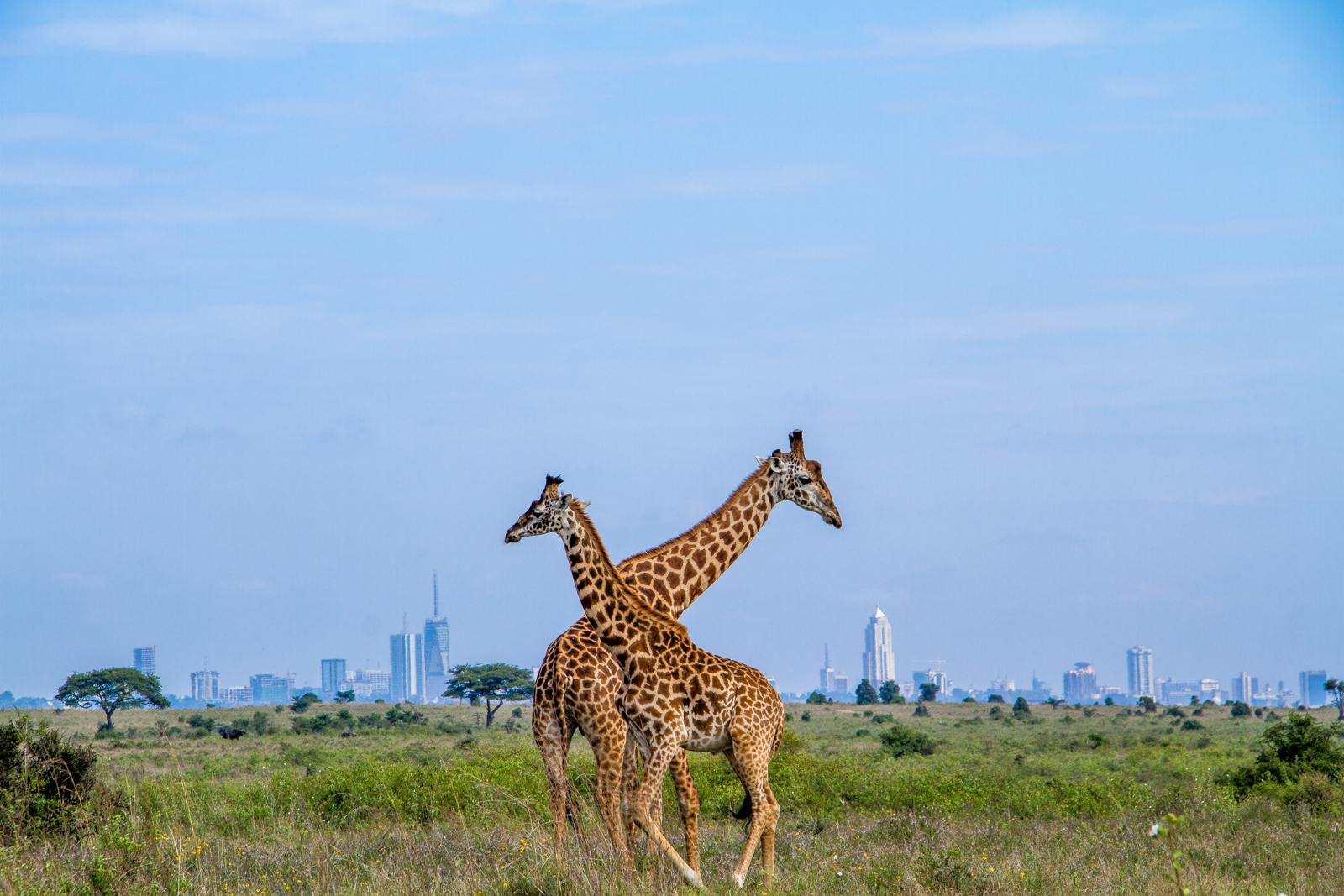
Maasai Giraffes in Nairobi National Park, on the outskirts of Nairobi, Kenya

Furthermore, accelerating urban growth—if poorly managed—could negatively impact the world’s response to climate change. How cities grow will affect the amount of energy they use for transportation and heating, with big implications for greenhouse gas emissions. And habitat lost to urban growth could release a lot of carbon currently stored in biomass. Urban growth, if occurring as forecast in our business-as-usual scenario, would destroy natural habitat that stores 4.35 billion metric tons of carbon dioxide, the equivalent of carbon dioxide emission from 931 million cars on the road for one year.

Cities will also be impacted by climate change in myriad ways, from hotter summer temperatures to more extreme rain events to sea level rise. In this report, we map where coastal natural habitats play a significant role in reducing coastal hazards during storms. In these stretches of coastline, we find that by 2030, urban area in these critical coastal zones could more than double to a total of 23,000 km2.

However, some of the dire predictions under our business-as-usual scenario need not happen. At the city level, the solution comes down to better planning and management of our urban growth. We advocate in the report for the incorporation of information on biodiversity and the benefits nature provides into urban planning decisions, to create a comprehensive vision of how nature can co-exist with and support cities—a greenprint for urban growth. Planning can protect biodiversity in natural habitats and maintain the health of our protected areas. Moreover, incorporating natural features, such as urban parks and street trees, into our cities will maximize the benefits that nature provides to people, from increased shade on a hot day to places to recreate and improve our physical and mental health.

Our report specifically focused on actions that national and international decision makers should take to protect nature. Local governments need to be better integrated into national planning decisions so that planning at each level incorporates the benefits of nature and reinforces decisions at other levels. International institutions have a role to play as well, in helping create the policies and provide the financial resources needed to implement many urban greenprints. Finally, the countries of the world need to begin discussing, within the Convention on Biological Diversity, how we can collectively work to make the urban century a positive one for the natural world.

The Nature in the Urban Century report was produced though the partnership of The Nature Conservancy, FutureEarth, The Stockholm Resilience Centre of Stockholm University, the Natural Capital Project, iDiv, The Nature of Cities, Urban Biodiversity Hub and ICLEI, including its Cities Biodiversity Center and the CitiesWithNature initiative.

The concept of ecosystem services or ‘nature’s benefits’ recognizes that the natural environment provides many critical and free services that contribute directly to human wellbeing and livelihoods. However, defining the spatial location of the areas that generate these benefits in order to mainstream them into planning frameworks remains a challenge in many cities of the global south.

The INTERACT-Bio project team used ‘natural asset mapping’ to identify and define the location of key ecosystem services in the nine project cities across Brazil, India and Tanzania. As a common baseline, high-resolution remotely sensed spatial data from the European Space Agency’s Sentinel 2 mission was captured during 2017 for each of the nine project cities. The project team worked closely with service providers GeoTerraImage to develop landcover classes that highlight areas which provide ecosystem services, such as wetlands, mangroves, grasslands and woody vegetation. This analysis resulted in a detailed spatial dataset that defines 12 different classes of landcover and can be used to generate a variety of mapping outputs and analytics for all three project countries.

In Tanzania, the ICLEI Africa INTERACT-Bio project team and UFZ technical support team worked closely with city partners to identify desired project outcomes as part of the project scoping exercise in 2017. A priority voiced by the Dar es Salaam city leadership was the need to identify and protect dwindling green open spaces within the city, to offset overexploitation of natural resources such as indigenous trees, and to mitigate some of the impacts of climate change such as the urban heat island effect.

To address this need, the INTERACT-Bio project team utilized a ‘thematic atlas’ approach to combine data and information generated from the remote natural asset mapping process with local spatial data, scientific studies and input from Tanzanian experts and city officials. The result, which is in the final stages of development, is a compendium of thematic maps and explanatory text that ‘make the case’ for the importance of green open space in Dar es Salaam. In addition to highlighting the status quo of ecosystem services in the city, the atlas provides good-practice policy responses and management interventions, towards aiding decision-makers in prolonging and maximising the benefits to citizens of green open spaces.

In line with their diverse contexts, the Brazilian and Indian INTERACT-Bio teams have adopted different spatial methodologies to mainstream biodiversity into planning and decision-making. These are however based on the same baseline methodology that was procured for natural asset mapping. This demonstrates the potential of combining customized earth observation data and information with input from local partners to aid city regions to make sustainable planning decisions.

Through co-production the thematic atlas on nature’s benefits, the INTERACT Bio project has produced a value-adding methodology and tool that can help cities make informed decisions about managing and investing in green open space and green and blue infrastructure. It can also help guide land use and development planning in a way that will enhance resilience and nature-based development. And it supports cities in building the case for investment in green space based on nature’s benefits (ecosystem services) and urban resilience considerations.

The INTERACT-Bio project is supported by the German Federal Ministry for the Environment, Nature Conservation and Nuclear Safety (BMU) through the International Climate Initiative (IKI).

Read more: www.international-climate-initiative.com


The best time to start is now.

Cool Number
0

Lorem ipsum dolor sit amet, consectetur adipiscing elit. Ut elit tellus, luctus nec ullamcorper mattis, pulvinar dapibus leo. Lorem ipsum dolor sit amet, consectetur adipiscing elit. Ut elit tellus, luctus nec ullamcorper mattis, pulvinar dapibus leo.

Cities need
  • trees.
  • parks.
  • birds.
  • wildlife.

Lorem ipsum dolor sit amet, consectetur adipiscing elit. Ut elit tellus, luctus nec ullamcorper mattis, pulvinar dapibus leo.

Lorem ipsum dolor sit amet, consectetur adipiscing elit. Ut elit tellus, luctus nec ullamcorper mattis, pulvinar dapibus leo.

Lorem ipsum dolor sit amet, consectetur adipiscing elit. Ut elit tellus, luctus nec ullamcorper mattis, pulvinar dapibus leo.

Lorem ipsum dolor sit amet, consectetur adipiscing elit. Ut elit tellus, luctus nec pulvinar dapibus leo. Lorem ipsum dolor sit amet, consectetur adipiscing elit. Ut elit tellus, luctus nec ullamcorper mattis, pulvinar dapibus leo.

Lorem ipsum dolor sit amet, consectetur adipiscing elit. Ut elit tellus, luctus nec ullamcorper mattis, pulvinar dapibus leo. Lorem ipsum dolor sit amet, consectetur adipiscing elit.

Lorem ipsum dolor sit amet, consectetur adipiscing elit. Ut elit tellus, luctus nec ullamc dolor sit amet, consectetur adipiscing elit. Ut elit tellus, luctus nec ullamcorper mattis, pulvinar dapibus leo.