Nature-based solutions in urban design: Participatory planning in Addis Ababa

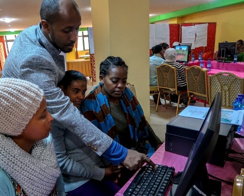
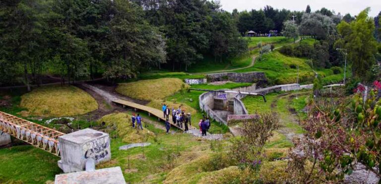
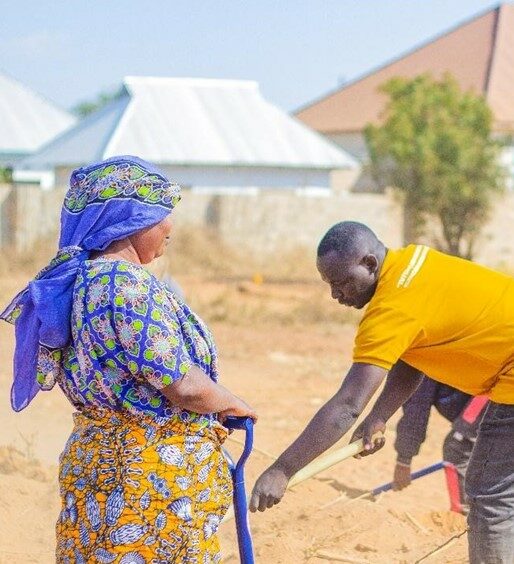
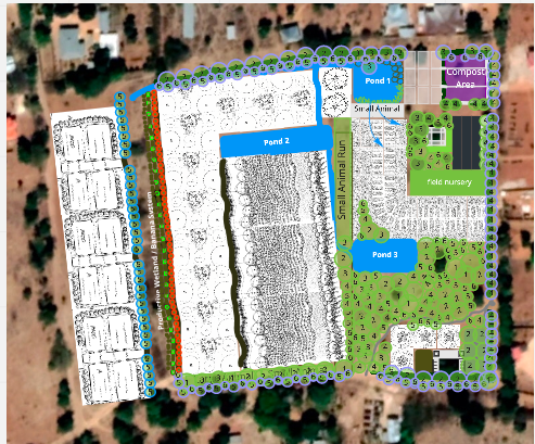
As part of the Urban Natural Assets for Africa: Rivers for Life (UNA Rivers) project, ICLEI Africa partnered with the Addis Ababa City Authority (Ethiopia) and UN-Habitat to implement Nature-based Solutions (NbS) in the redesign of a riverside site in Addis Ababa. The project focused on leveraging the integration of urban green spaces into urban planning as a pathway to enhance climate resilience, safeguard biodiversity and improve community well-being.

Central to this process was a participatory workshop utilising an adapted version of the video game Minecraft, which enabled inclusive planning among city officials and community members. Nearly half of the participants were women and over 60% were youth, including vulnerable groups such as those experiencing homelessness. .

Participants visited the site to understand environmental challenges and opportunities firsthand. They then worked in small groups to co-design green, accessible public spaces that protect and restore the river ecosystem. Despite their limited experience in technology, participants not only improved their computer literacy but also contributed practical, cost-effective solutions rooted in nature and their lived experiences. 

The designs emphasized key components of urban NbS such as green corridors, natural flood buffers, shaded gathering areas and restored riparian zones. Site visits and hands-on tools were crucial in raising awareness of the value of natural assets in cities.

By combining digital tools with community knowledge, the process not only produced strong design outcomes but also built long-term capacity and social cohesion to ensure sustainable, inclusive urban development through nature-based approaches. By taking a bottom-up approach to NbS, the park went from an underutilised informal waste dump, to an inclusive and thriving urban park for all. 

Want to find out more?

Cooling the city through trees: Melbourne’s Urban Forest Strategy

In response to rising urban temperatures, extended droughts and declining tree canopy health, the City of Melbourne (Australia) developed the Urban Forest Strategy. This Nature-based Solution (NbS) has helped to create a cooler, greener and more liveable city. With over 70% of Melbourne’s public trees projected to decline by 2050 due to climate stressors, action was urgent and long-term in vision.

The strategy set ambitious goals: to increase urban canopy cover from 22% to 40% by 2040, reduce the urban heat island effect and enhance the health and resilience of the city’s tree population. A key principle of the strategy was that trees are not just aesthetic additions, but vital green infrastructure that support climate adaptation, biodiversity and community wellbeing.

Implementation began with comprehensive mapping of existing canopy cover and tree health across the municipality. Priority planting areas were identified based on vulnerability to heat and low green space access. The programme also emphasised community participation, inviting residents to suggest planting locations and even write letters to the city’s trees. This public engagement initiative went viral and fostered a deeper connection between residents and the urban forest.

Tree planting was paired with integrated water management, such as passive irrigation and stormwater harvesting, to ensure long-term viability. Drought-tolerant and diverse species were selected to build ecological resilience.

Melbourne’s urban forest is now seen as essential to public health and climate resilience. Trees planted under the strategy are expected to reduce street-level temperatures by several degrees, improve air quality and offer shade and comfort during extreme heat. Green spaces also promote mental health, support local wildlife and contribute to carbon sequestration.

The strategy demonstrates how cities can plan for climate adaptation by treating nature as infrastructure. It provides a replicable model for urban NbS that links environmental performance with social and economic co-benefits, strengthening community ownership and long-term sustainability.

Want to find out more?

Restoring catchments for water security in Cape Town

As part of efforts to build long-term resilience to drought and water scarcity, Cape Town, South Africa has implemented various Nature-based Solutions (NbS) focused on restoring ecological function in key water catchment areas. One of these projects, led by The Nature Conservancy through the Greater Cape Town Water Fund, in partnership with national and local governments, targets the removal of invasive alien vegetation to improve water yields and protect biodiversity.

Cape Town faced severe drought conditions between 2015 and 2018, with the 2018 “Day Zero” crisis highlighting the urgency for alternative water strategies. Scientific studies showed that invasive trees such as pine and acacia were consuming up to 55 billion litres of water annually, a significant amount of water that would otherwise flow into the city’s dams. Restoring these ecosystems became a clear and cost-effective solution to complement built infrastructure.

Clearing activities were focused in key catchments, including the Upper Steenbras and Berg River areas. Local teams, many of them previously unemployed community members, were trained to remove invasive species and restore native fynbos vegetation. This participatory and labour-intensive process not only improved water security but also created livelihoods and reduced wildfire risk.

Monitoring and evaluation were embedded throughout the programme, showing tangible increases in streamflow and positive ecological outcomes. Crucially, the NbS approach helped reframe watershed restoration as a vital component of urban water strategy that moves beyond emergency responses to embrace long-term, climate-resilient planning.

The initiative demonstrated that investing in ecosystems can be as important as investing in pipes and pumps. The water fund model also highlighted how partnerships across public, private and civil society sectors can unlock financing and co-benefits, including improved biodiversity, fire risk reduction and social equity through job creation.

Restoring nature has become central to Cape Town’s urban resilience strategy. The work continues to inform how other African cities can turn to their surrounding natural assets not just for beauty or biodiversity, but as critical infrastructure in the face of a changing climate.

River Sampling | Scientist Kate Snaddon assesses the biodiversity impacts of the Greater Cape Town Water Fund’s invasive plant removal efforts in the Theewaterskloof catchment area. © Jeremy Shelton

Want to find out more?

Championing high-altitude urban wetlands for climate and community in Quito, Ecuador

Quito, Ecuador’s capital city, is situated high in the Andes and is home to more than 2.8 million people. Despite its dense urban core and rapid expansion, Quito has prioritized the protection and restoration of its high-altitude wetlands as a central element of its urban resilience strategy.

These wetlands, including La Chimba and La Mariscal, play a vital role in managing stormwater, reducing flood risks, recharging aquifers and providing critical habitat for native and migratory species. They also help regulate local temperatures and store carbon, reinforcing their value as Nature-based Solutions for climate adaptation.

Quito’s commitment is embedded in its Resilience Strategy and Metropolitan Development Plan, which integrates wetland conservation into land use, ecological zoning and infrastructure planning. The city collaborates with national ministries, civil society and indigenous communities to advance wetland restoration, education and monitoring efforts. Community stewardship programs, including “Adopt a Wetland,” have empowered local residents to care for these ecosystems while fostering environmental awareness.

Quito’s work demonstrates that even in high-altitude, fast-growing cities, wetlands can be leveraged to improve public health, biodiversity and climate resilience. The city is actively exploring Wetland City Accreditation under the Ramsar Convention and aims to inspire other Latin American cities to recognize the strategic role of wetlands in sustainable urban development.

Implementation of NBS in the Caupicho Ravine © YES Innovation

Want to find out more?

Integrating nature, food and mobility: The Dodoma Food Way in Dar es Salaam

As one of Africa’s fastest-growing cities, Dar es Salaam (Tanzania) faces immense challenges related to rapid urban expansion, environmental degradation, food insecurity and inadequate infrastructure. In response to these intersecting issues, the Integrated Action on Biodiversity (INTERACT-Bio) project, supported by the German Federal Ministry for the Environment, Nature Conservation and Nuclear Safety (BMU) through the International Climate Initiative (IKI) , implemented by ICLEI Africa in partnership with the city, developed a visionary planning concept known as the Dodoma Food Way. This initiative reimagines urban space as a multi-functional, inclusive corridor that links Nature-based Solutions, food systems and non-motorised transport, while addressing biodiversity loss and socio-economic vulnerability.

The Dodoma Food Way concept was developed through a participatory process that brought together local authorities, ward officials, informal traders and ICLEI’s technical team. It envisions a linear green corridor that restores degraded land, enhances ecosystem connectivity, and simultaneously supports informal food production, urban agriculture and pedestrian movement. The route is designed to connect local producers and vendors to markets, support daily mobility through safe walking and cycling infrastructure, and preserve critical urban natural assets such as wetlands, floodplains and open space.

A critical element of this initiative was the use of spatial planning tools developed under INTERACT-Bio. The Thematic Atlas served as a key decision-support tool, offering a layered visualisation of biodiversity, infrastructure, food systems and socio-economic factors. It allowed planners to identify synergies and trade-offs by highlighting areas where ecological restoration and social benefits could align. Complementing this, the Urban Natural Assets Map helped identify areas at risk of degradation or flooding, enabling better targeting of interventions that enhance urban resilience.

By linking ecological infrastructure with informal food systems and inclusive mobility, the Dodoma Food Way breaks from traditional sectoral approaches and demonstrates how African cities can plan for people and the planet simultaneously. The project also highlights the value of co-creation, as community knowledge and lived experience shaped both the design and vision for implementation. The corridor not only offers climate and ecological benefits, but also supports livelihoods, improves public health and fosters social cohesion.

While still in the pilot stage, the Dodoma Food Way offers a scalable and replicable framework for cities across the Global South. It illustrates how nature-based Solutions can be leveraged not only for environmental protection but also for building equitable urban futures grounded in the daily realities of African cities. The integration of tools like the Thematic Atlas and UNA Map into the planning process also demonstrates the importance of evidence-based, spatially informed decision-making for achieving long-term sustainability.

Want to find out more about the INTERACT-Bio project?

Want to find out more about the Dodoma Food Way?